MAPS
(Click on image to open map)
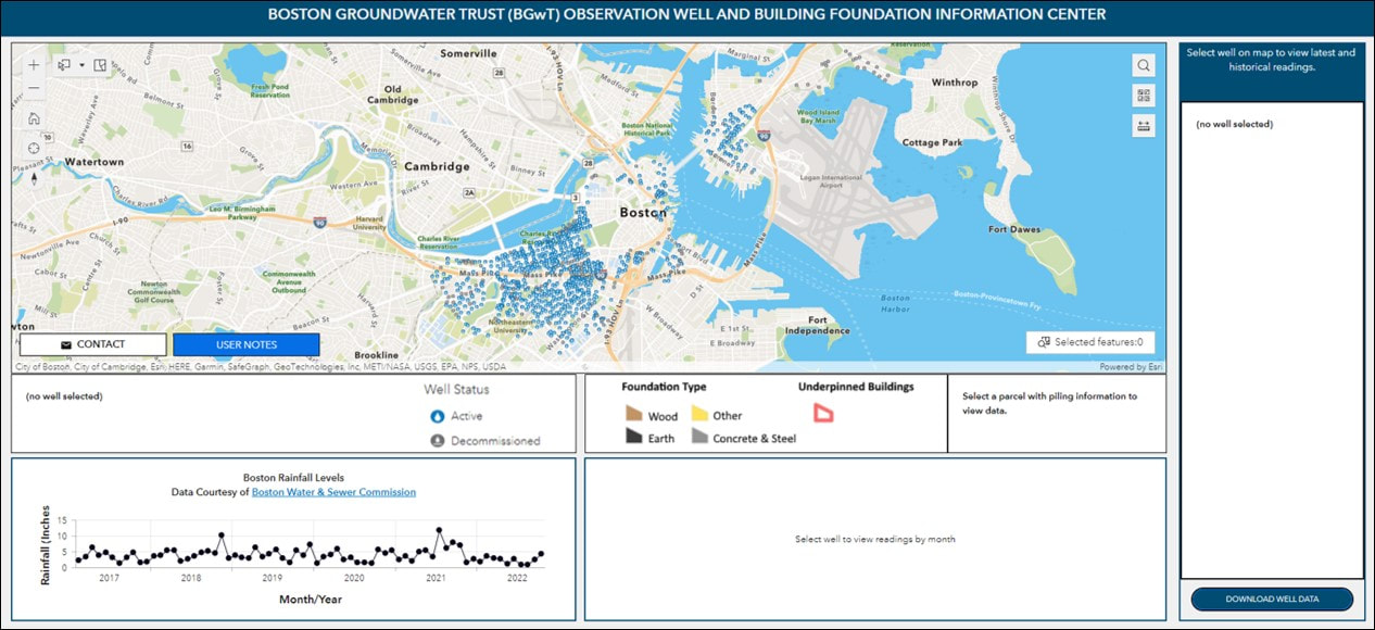
OBSERVATION WELL AND BUILDING FOUNDATION INFORMATION CENTER
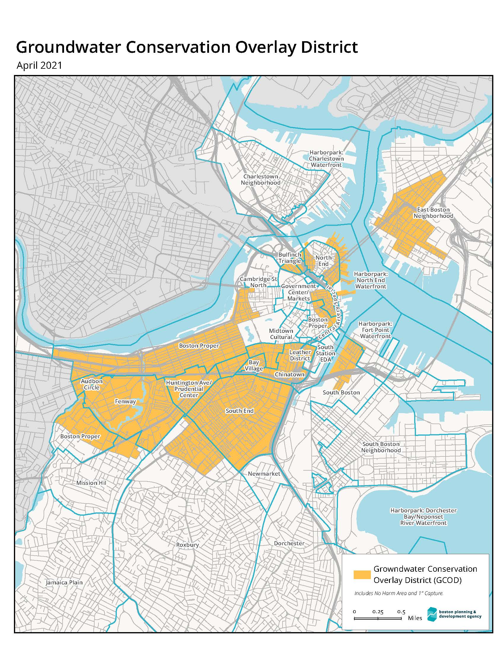
Groundwater Conservation
Overlay District (GCOD) Map
Approximate Location of
1630 Colonial Shoreline Map
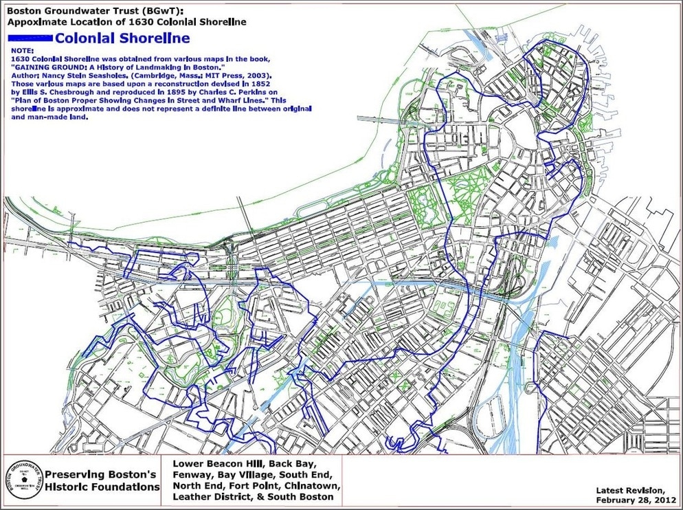
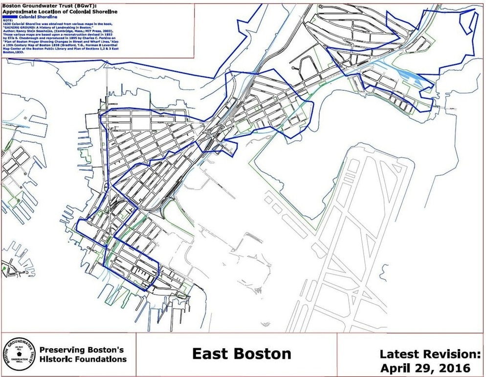
Approximate Location of
East Boston Shoreline Map
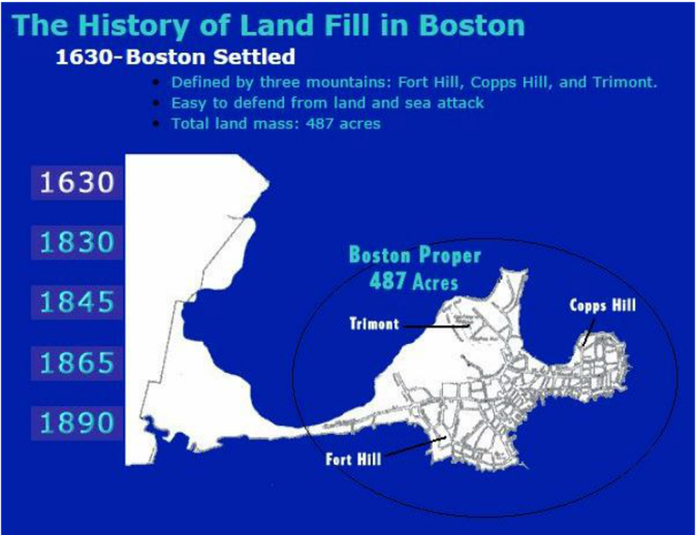
Interactive Map: The History of Land Fill in Boston
(link courtesy of iboston.org)